Exploring a Railway Legacy Hiking the E&N
BC history faces increasing challenges. Historic sites and museums are experiencing funding cuts, public figures who shaped our past are losing recognition, and railways that once built nations are being abandoned. Vancouver Island’s Esquimalt & Nanaimo Railway (E&N)—although it’s not even called that anymore—is a prime example. Its last spike was driven in 1886 by Robert Dunsmuir and Sir John A Macdonald. Today, just six miles of track within the City of Nanaimo remain in service.
Yet, where trains no longer run, people are finding new purpose for the track. Walking the rails has become a way to connect with history and appreciate an industry on the brink of disappearance. This guide highlights four accessible sections of the E&N. Along the way, I’ll share practical tips and historical insights. Lace your boots, grab your camera, and let’s explore this storied landscape.
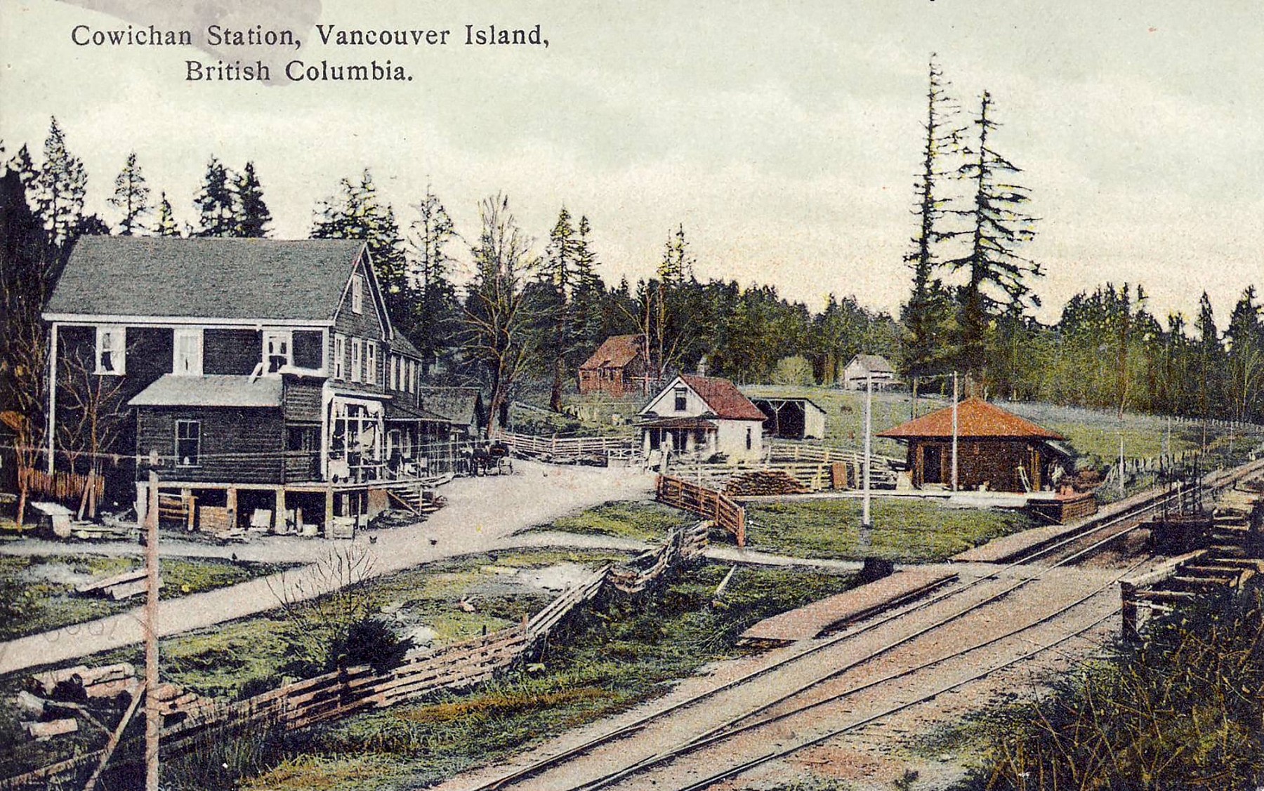
Cowichan Station as it appeared on a postcard at the beginning of the last century. Published by the local general merchant, who must have had great pride in—and dreams for—his establishment. There is no sign of it today.
Before you begin, it’s important to know this railway’s right-of-way remains private property, and walking there is technically trespassing. In some areas, parallel trails have been established by local governments as alternatives. These descriptions, however, are for those drawn to sections where no trains have run for over a decade.
Stay safe and oriented by using maps on your phone. Watch for maintenance workers—they’re rare but worth treating with respect. Be cautious crossing roads and bridges, and note that railways measure distances in miles, not kilometers. Many structures and signals still bear mileage markers, referencing Victoria’s former station as Mile Zero.
Mile 35.5 to 37.9
Koksilah River Section • Koksilah Area
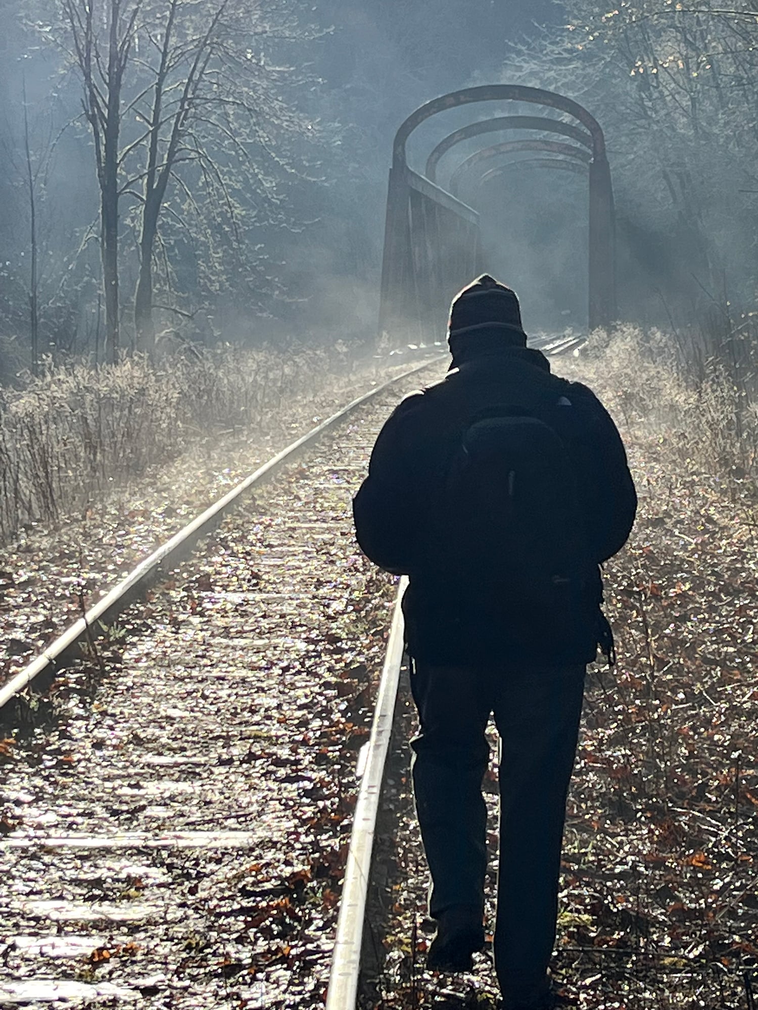
Approaching Koksilah River E&N bridge in a frosty November morning. Photo © TW Parkin
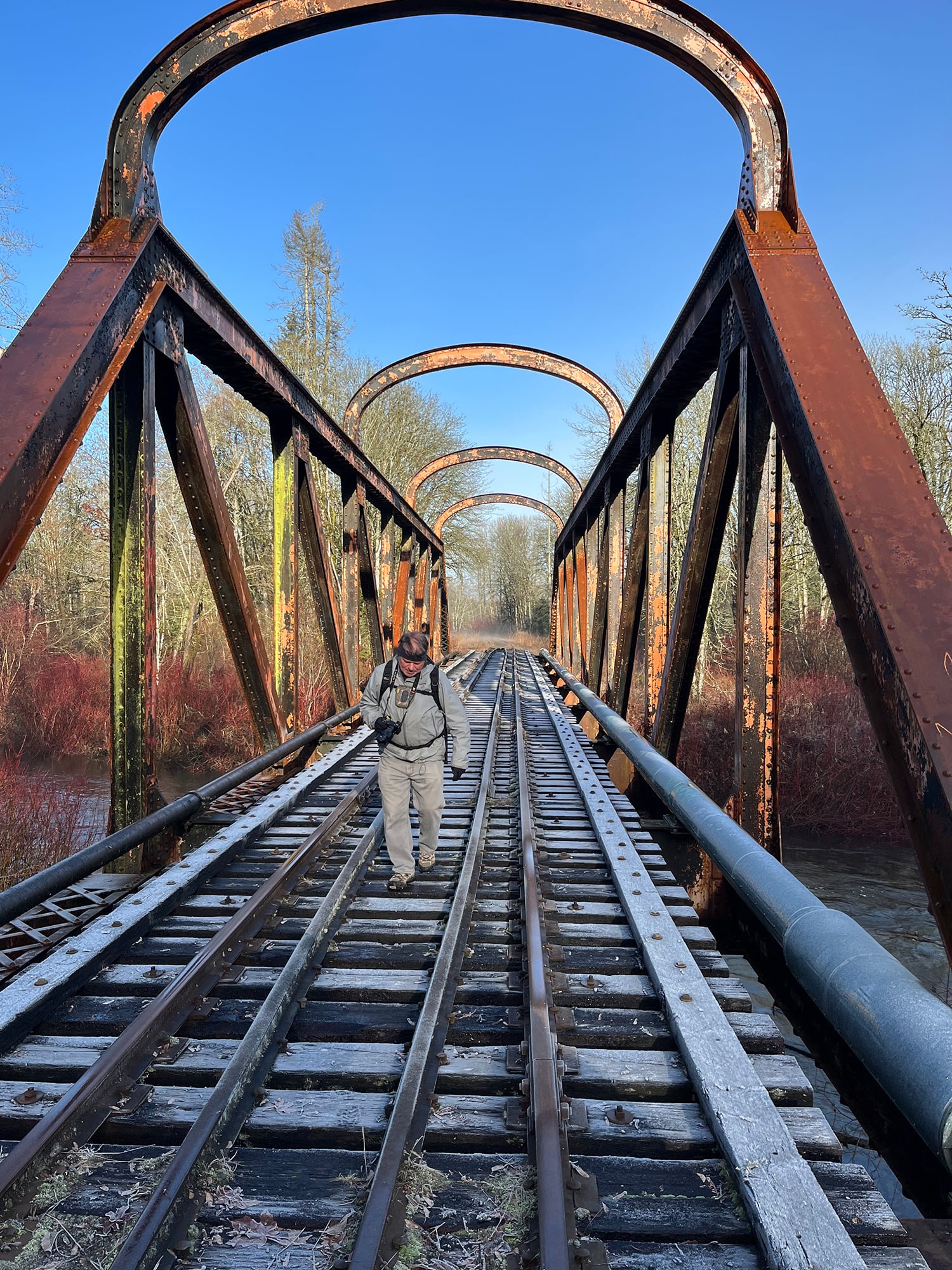
The Koksilah River bridge features distinctive “basket handle” arches. One of the side-pipes serves as a conduit for TV cable. Photo © TW Parkin
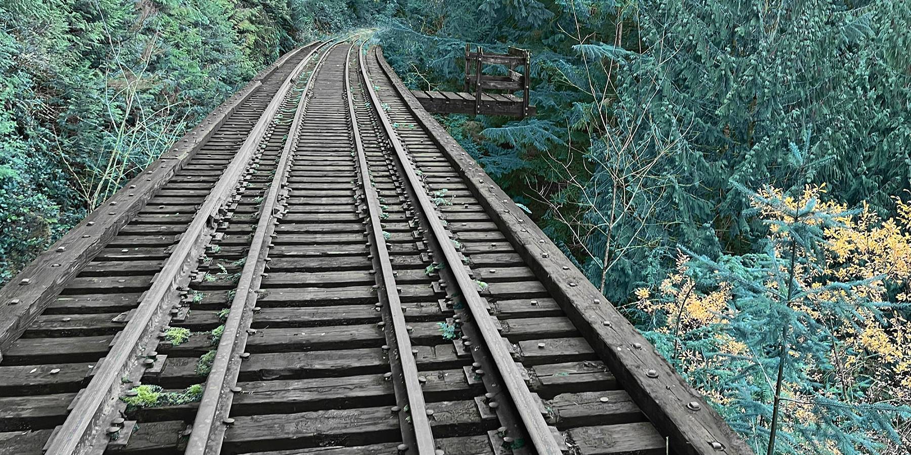
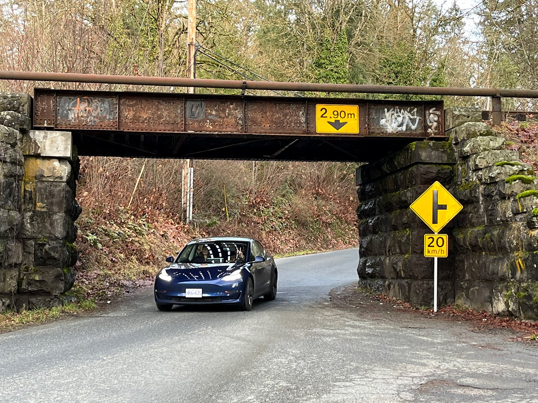
This 2.4 mile length of track has particular appeal for scenery, much of it running past the Koksilah River and hayfields. The route stretches between the former flag stop of Cowichan Station in the south and Miller Road crossing in the north. Miller Rd is located directly across Highway #1 from The Old Farm Market.
Near the south end, Bright Angel Regional Park can be used as a rendezvous for those arranging pick-ups or drop-offs. It provides a well-maintained area for lazing about, picnicking, and excited children. If you prefer, a suspended footbridge over the river from the park to the railway can be used to cut off 0.9 mile of walking south to Cowichan Station (near Koksilah Road).
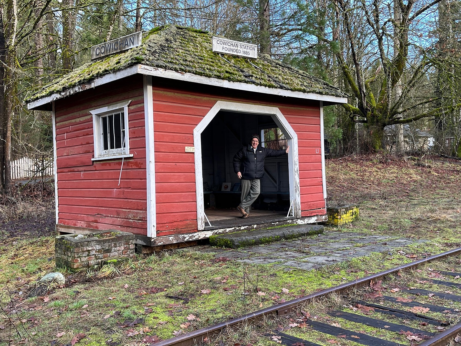
The original shelter at Cowichan Station was replaced by this timeworn shelter. Before 1896, the hamlet was named McPhersons. Photo © TW Parkin
A passenger shelter at Cowichan Station bears a sign dated 1885, but means only that it stands on the site of the original shelter. After this you can picnic in a small riverside park beside a timber truss over Koksilah River. You won’t find many of these Howe trusses left in BC, so take a walk across to admire this piece of forgotten BC.
If you don’t want to walk this entire length of track, consider visiting an interesting steel through truss over the Koksilah River, just 0.2 miles south of Miller Road. This “basket handle” design was erected here in 1940. Like other CPR bridges, it was brought in after prior service elsewhere. A similar structure over the Tulameen River near Princeton still serves on what is now the Kettle Valley rail trail, so this Island bridge may once have been on that line.
Koksilah Road at Cowichan station. Abutments such as these, sawn from sandstone, replaced much timberwork when the CPR upgraded the original Dunsmuir structures upon acquiring the line. Photo © TW Parkin
Mile 39.3
Cowichan River Bridge • Duncan, BC
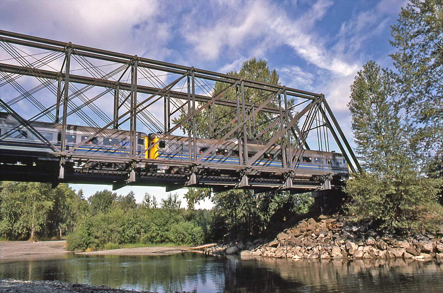
VIA Rail crosses the Cowichan River, 6 August 1984. Built by the Budd company, these units are known by train spotters as rail diesel cars. As rail passenger service declined across North America, RDCs were often the last mode of passenger transport on unprofitable routes. Photo © Maynard Atkinson
CP’s vintage Fraser River (Cisco, BC) bridge now erected over the E&N’s Niagara Canyon garners more attention, but this Cowichan River truss is more easily reached and has an even longer history. It dates from 1876 when bridge iron still incorporated Victorian flourishes like flower designs “just for pretty.”
Its designer was New Yorker Squire Whipple, and he was among the first engineers to understand the stresses which cause trusses such as this to ‘work’. Thus it’s called a Whipple through truss. “Through” simply means it carries its load within its own structure, rather than, say, over it.
The manufacturer in this instance was Phoenix Iron Co of Philadelphia, which made this span for the Pennsylvania Railroad at a location near Altoona, PA. Becoming too light for that purpose, it next helped the CPR cross the St. Maurice River in Québec in 1892. The CPR moved it here in 1907 during upgrades to the line following its purchase of the E&N from the Dunsmuir family.
It's a piece of history few expect to find in Duncan.
It recalls a Meccano erector set from my boyhood. That this bridge still stands is testament how well things were designed and built in an earlier century, long before modern metallurgy. The vertical columns, embossed with the Phoenix name, were patented structures which could bear more weight than previous designs.
The CPR was once mocked as “the Cheapy R” in recognition of its thrift. Whether by design or happy accident, the railway has preserved one of the most significant heritage bridges in Canada, and the only Phoenix through truss. It's a piece of history few expect to find in Duncan.
For more information, also see Turner and MacLachlan’s authoritative The Canadian Pacific’s Esquimalt & Nanaimo Railway: the CPR Steam Years, published in 2012.
The bridge and the river are on land claimed by the Quwʼutsun Nation, but everyone can splash in the river, come summer.
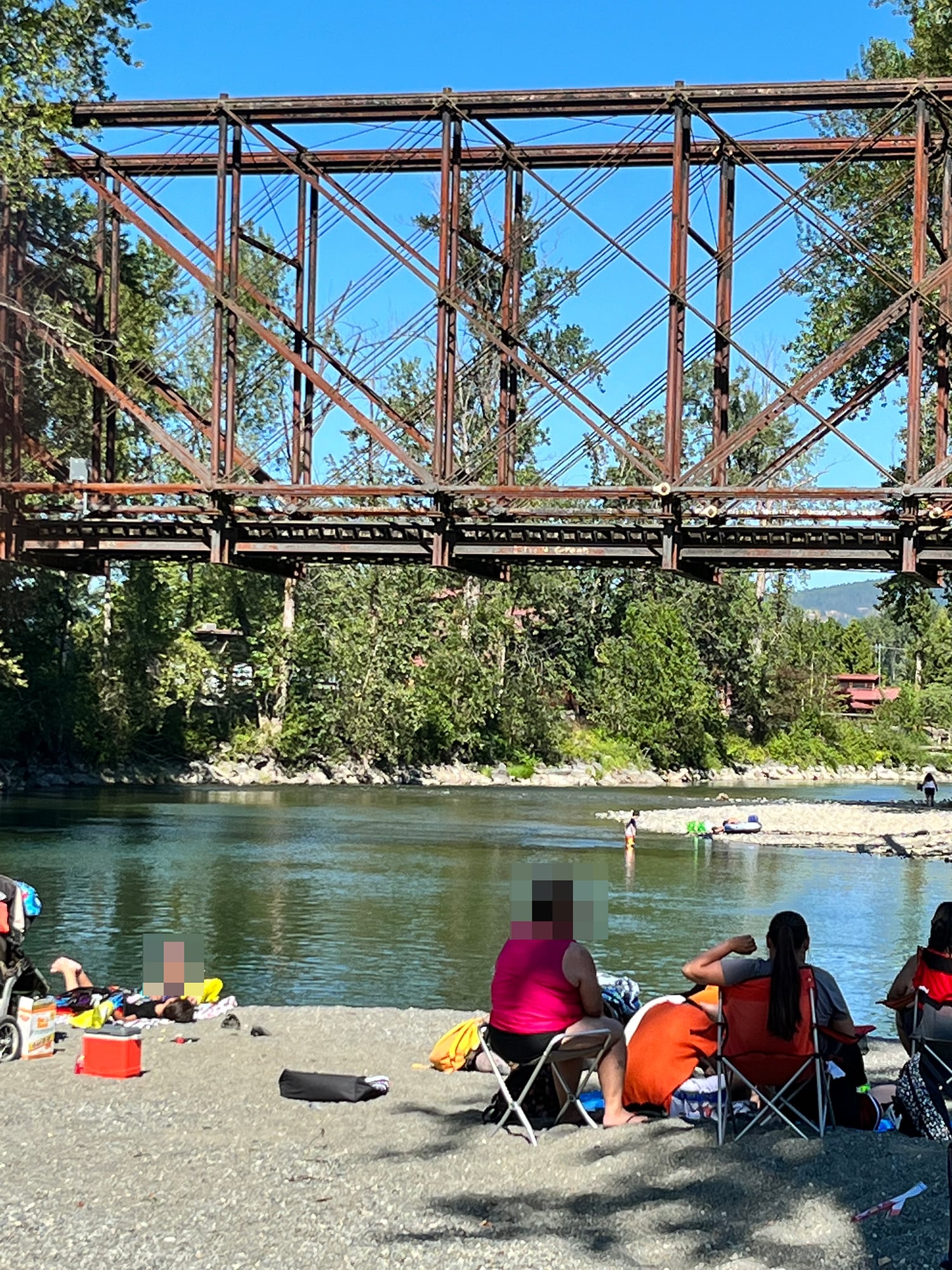
Ye ol’ swimmin’ hole beneath the Cowichan River bridge, Duncan. This structure was forged 148 years ago. Photo © TW Parkin
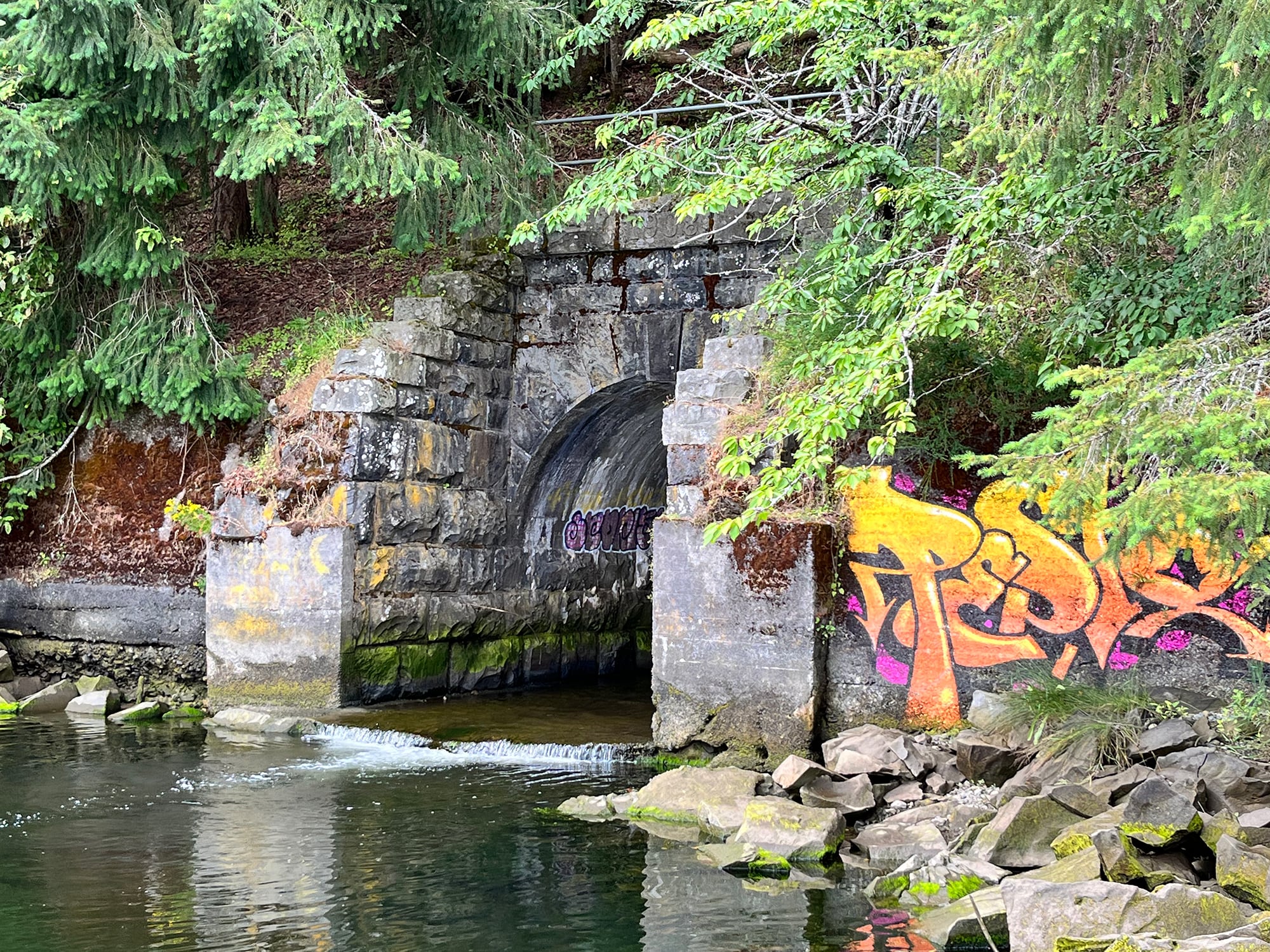
Holland Creek at low water. This is the exit portal of a barrel culvert at Ladysmith, built in 1908. During certain times of the year, salmon use this dark passageway to reach upstream spawning gravel. Photo © TW Parkin
Mile 86.8 to 89.6
Nanoose S-Bend • Nanoose Bay, BC
Listen to Tom read this quote:
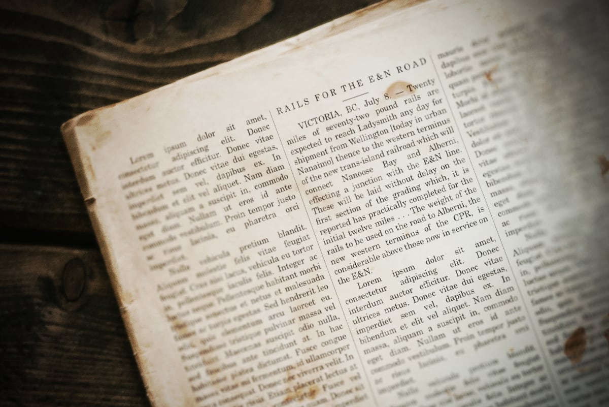
VICTORIA, BC, July 8. — Twenty miles of seventy-two pound rails are expected to reach Ladysmith any day for shipment from Wellington [today in urban Nanaimo] thence to the western terminus of the new trans-island railroad which will connect Nanoose Bay and Alberni, effecting a junction with the E&N line. These will be laid without delay on the first section of the grading which, it is reported has practically completed for the initial twelve miles . . . The weight of the rails to be used on the road to Alberni, the new western terminus of the CPR, is considerable above those now in service on the E&N.
This rural mileage has four road crossings, creating optional short returns should you want off the track for any reason. NW Bay Road also passes two service centres where food and drink may be purchased. Use Google maps to understand the lay of the land. Turn off Highway #19 at Nanoose Beach Road and park away from the rails and off the road. Start walking to the north.
| Nanoose Beach Rd | 86.6 | X-ing |
| Nanoose station | 86.7 | Former siding, 982 feet, park here |
| Bonell Creek | 86.8 | 66-ft deck plate girder, 1909 |
| NW Bay Road 1 | 86.9 | X-ing |
| Nanoose Creek | 87.2 | 46-ft deck plate girder, 1909 |
| NW Bay Road 2 | 87.8 | X-ing |
| Powder Point Road | 88.1 | X-ing |
| NW Bay Road 3 | 88.6 | X-ing |
| Private X-ing | 89.0 | No public access |
| Sanders Road | 89.9 | North end, Bryn siding |
The core of this pastoral walk is barely two miles, one way. These end points are Nanoose Station Road and Northwest Bay Road crossing #3, but extensions from either end are possible. The grade rises gently with the rising mileage, and passes through an area of rural acreages with curious sheep, alpacas, and the occasional backyard dog. The encroaching natural vegetation still allows walkers to pass without getting snagged in broom or blackberries. Birders and wildflower photographers may find subjects of interest.
Back at the beginning (Mile 86.7), south from Nanoose station (toward Nanaimo), the track parallels the shore of Nanoose Bay. For those seeking a longer walk, this extension offers views of tidal flats, oyster farms, and ships at the Canadian Forces Maritime Experimental and Test Ranges (CFMETR) across the water.
The encroaching natural vegetation still allows walkers to pass without getting snagged in broom or blackberries.
From NWB #3 to the north, the route is less scenic. After a mile it reaches the former flag stop of Bryn, now marked by two derelict buildings and a 1,434-foot siding. Its north end reaches a switch at Sanders Road, where walkers might pre-position a vehicle for their return drive (3.1 miles by road). First though, slake your thirst at nearby Rocking Horse Pub! With good timing, you can also catch a southbound bus back to the Island Highway #19. Check its schedule on Regional District of Nanaimo transit route #91.
Bryn is short for Brynmarl, the name of a former post office which operated intermittently here. Brynmawr is Welsh for "high hill”. This name must have come about because this is the top of the rise which the railway has to climb using an elongated S-bend.
Did You Enjoy This Article?
Sign Up for More!
“The Parkin Lot” is an email newsletter that I publish occasionally for like-minded readers, fellow photographers and writers, amateur historians, publishers, and railfans. If you enjoyed this article, you’ll enjoy The Parkin Lot.
I’d love to have you on board – click below to sign up!