
Cascade Creek Arch Spanning an Era of Railway Development
Many’s the driver along the Trans-Canada Highway through Rogers Pass, BC, who points out the Selkirk mountain scenery to a passenger. High on the east slope, above the eastern portal of the Connaught Tunnel, is a stone arch that once carried the CPR over a short, steep stream. Time and forest growth have slowly veiled the view of this historic site, so much as it has faded from the memory of modern railroaders.
This account revisits the remarkable transformation of Cascade Creek from a site of recurring disaster to one symbolizing the innovation and resilience of railway engineering.
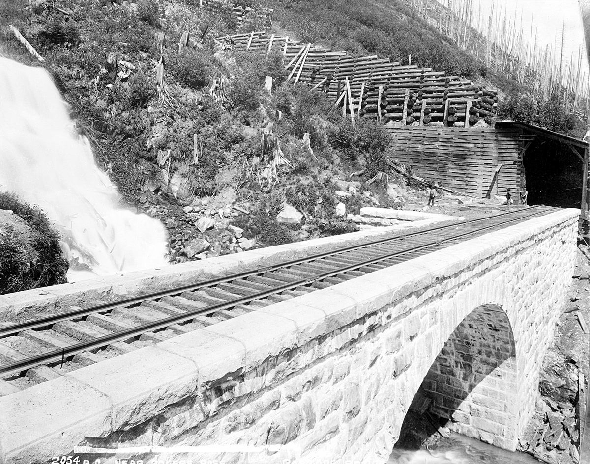
Originally a trestle wiped out by successive avalanches, this stone bridge over Cascade Creek was built in 1898, abandoned in 1917 due to the Connaught Tunnel realignment, and still stands (with refurbishment by Parks Canada). This image including section men is characteristic of CPR engineer/photographer Joseph Heckman. The stone abutment in front of the men suggests it was part of a temporary shoo-fly. Heckman visited on 18 July 1899, and recorded it as Mile 429.75 (W). Vancouver Public Library photo no. 830.
The Snow War
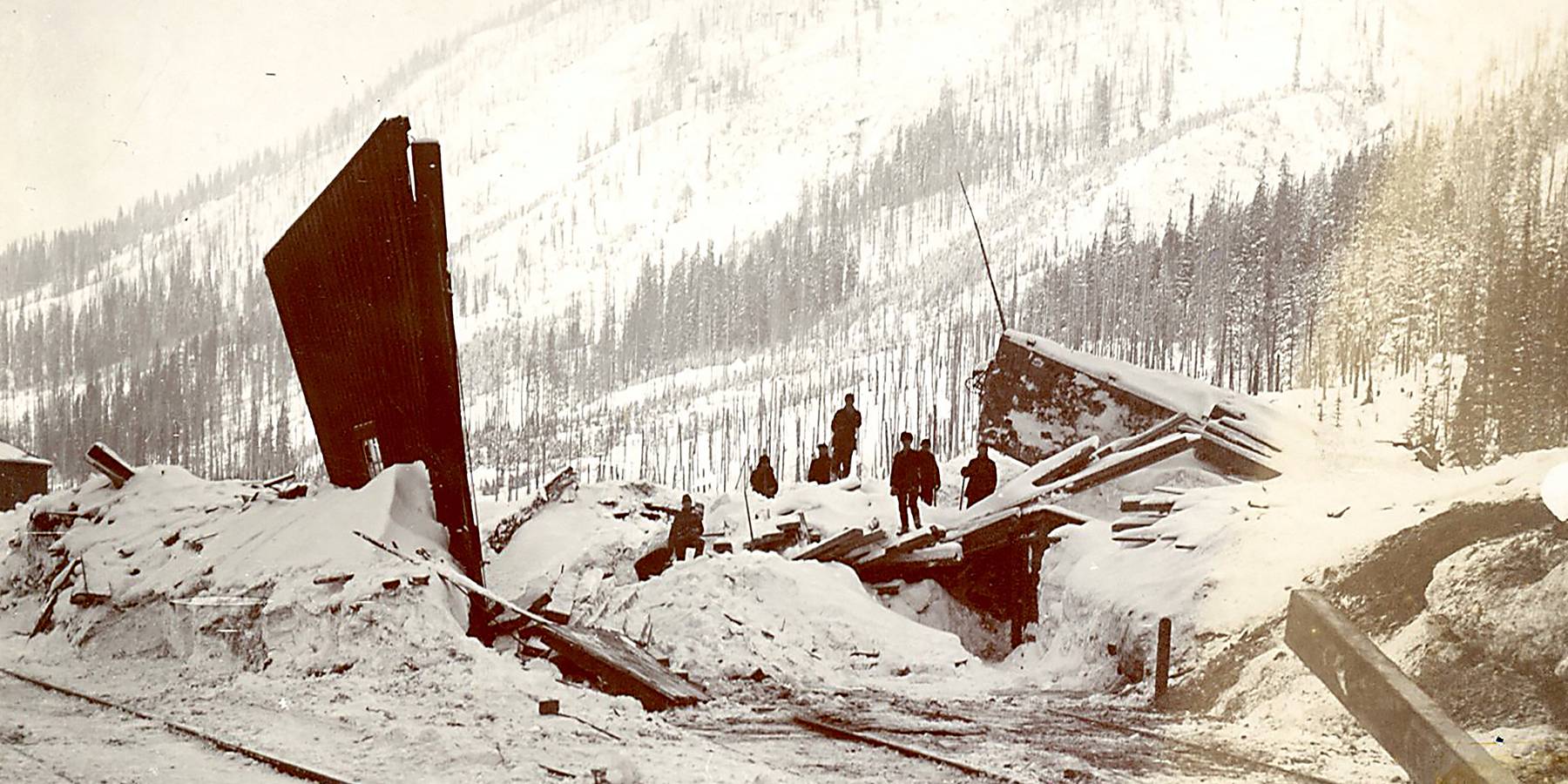
It was the opening of the Connaught Tunnel in late 1916 which reduced the railway’s effort to climb over Rogers Pass on a 2.1% grade along this section. The tunnel provided other advantages as well, one being avoiding avalanches which unpredictably closed the line every winter. Some were mitigated by snowsheds; three east of Cascade Creek, and 28 to the west (toward the divisional point of Revelstoke).
Between 1886 and 1898, the trestle was wiped out six times, so crews were not unaware of the danger.
Not that the CPR didn’t expect avalanches when it chose this route, but no one had a thorough understanding of where there could be problems, or what to do about them. Rushing to simply connect the line by November 1885, they cantered into a Snow War1 like blinkered workhorses, unknowing when an enemy might strike from beyond vision.
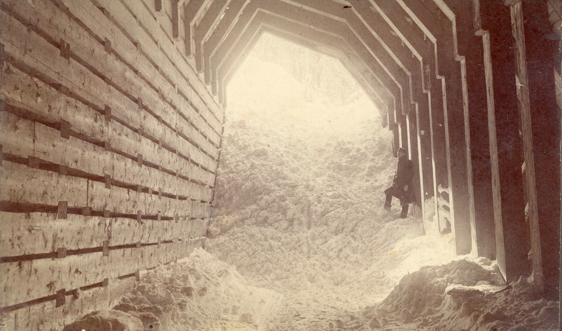
View from the interior of a snowshed, circa 1886. Subsequent to such experiences, rock-filled ‘glance cribs’ were built uphill to guide oncoming slides away from snowshed portals. City of Vancouver Archives photo Can P202.
—A camp of engineers are stationed at Cascade Creek; another camp at a point five miles of summit, to report on snow slides, as to their depth and direction, so to facilitate the building of sheds during the coming summer. The snow at the summit of Selkirks is from eight to ten feet deep, but very dry. The slides have not commenced to any extent, as it requires warm weather to start them.
That measurement of snowfall was surely accurate, but the white witch of winter had only started to howl by that date. Typical snowfalls at the summit, in those days, exceeded 30 ft (9.1 m), or even, the year following masonry construction at Cascade Creek, 43 ft (13.1 m)!2
Situated in a gully with a permanent stream, Cascade Creek was badly exposed to avalanches. The track initially crossed the gulley on a trestle, as was standard design. No plan has been found for it, but in an 1885 book published the year of its completion, gives a dimensions of 350 ft (106.7 m) long and 67 ft (20.4 m) high.3
Bedrock here is very close to the surface. Thus driving piles wasn’t always possible, so mud sills (timbers laid on the surface to which vertical supports are affixed) would have been a partial solution. Some footings would have been stabilized later by rock fill. Such structures are inherently unstable, suffering both fluctuations of water flow in summer and sliding snow in winter. Between 1886 and 1898, the trestle was wiped out six times, so crews were not unaware of the danger.
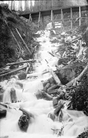
This image is likely how the CPR first crossed Cascade Creek. How/why it was knocked out so often in its first years is evident.
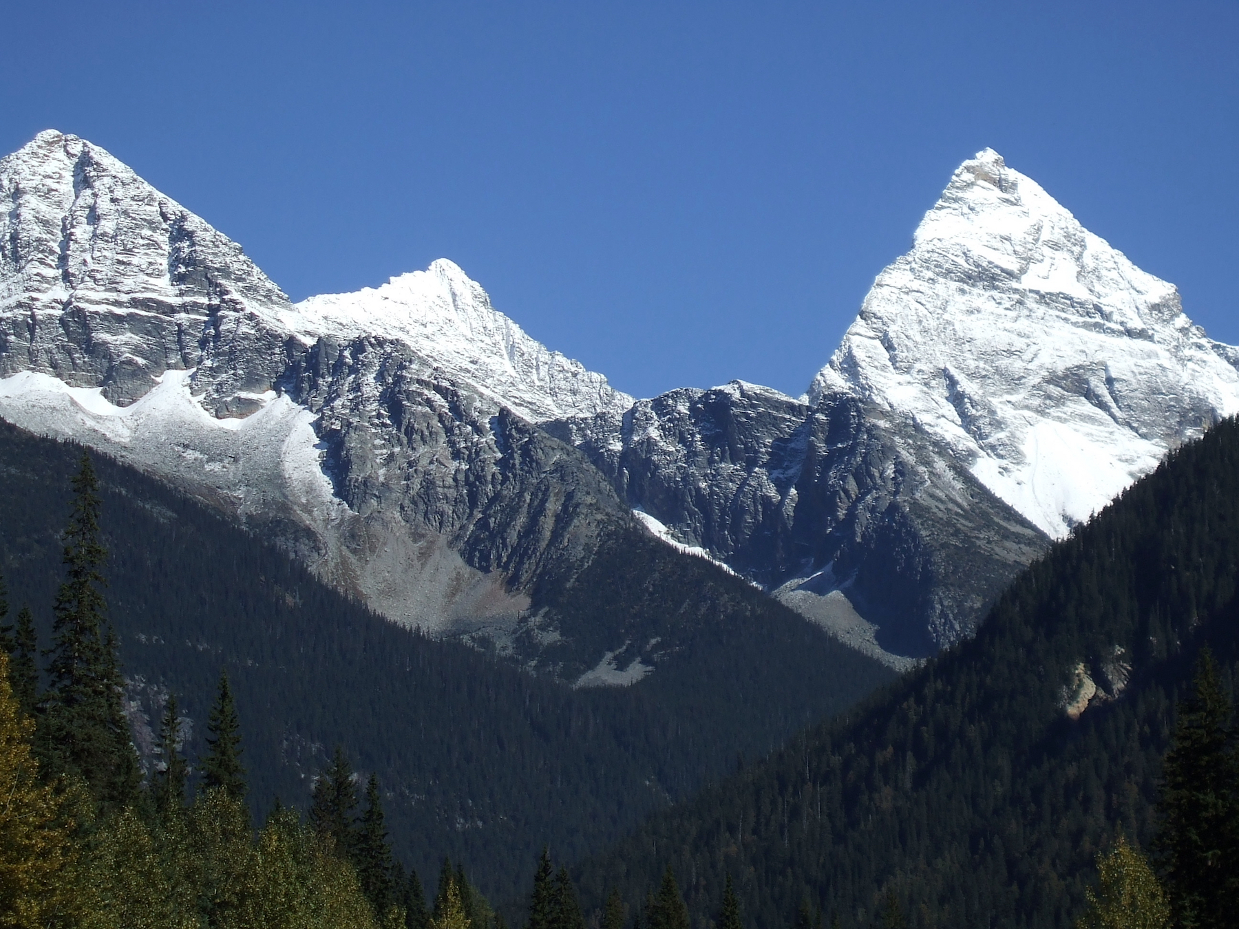
Mount Sir Donald (10,774 ft; 3,284 m), named for Donald Smith the financier who helped birth the CPR, rises a mile above the track out of sight in this view from Glacier, BC, by author TW Parkin.
FATAL SNOW SLIDES.
Winter Railroading in the Selkirks- -
Trains Caught in the Avalanches.__________
Engines Upset - - - Workingmen
Buried Alive - - Six Dead - - -__________
Special to THE TIMES — Reports from Rogers Pass state that on the 27th over two feet of snow fell in the Selkirks and slides became general, but they passed over all the snow sheds on the line without doing any damage.
A SERIOUS ACCIDENT
occurred that day at Cascade Camp where two engines and a working train were at work. An immense slide came down which caught both engines and the snow plow, upsetting them and burying 16 of the workmen. Immediate steps were taken to release the imprisoned men and all were taken out alive except for six whose names are as follows:THE DEAD:
Henry Evans, Wm. Ryan, W.S. Green, C. Stark and Smith and Johnson, the crew of the engine, No. 365. Several narrow escapes from accidents occurred during the work of digging out of the men owing to small slides coming down. A report last night stated that a large force of men were at work and it was expected that the track would be clear on the 5th.
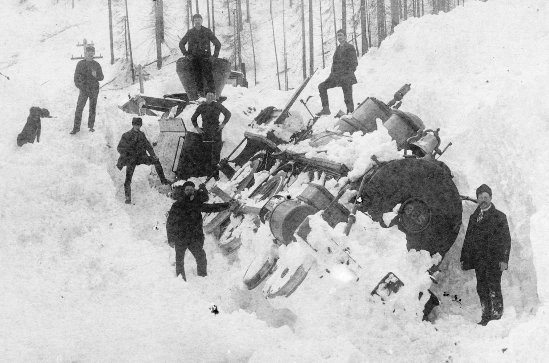
Digging out the buried train of 1887. From other photos, the consist is known to have been a snow plow, followed by locomotive 365 (shown here) paired with another loco, plus a caboose. Photo Can P199 from the City of Vancouver Archives.
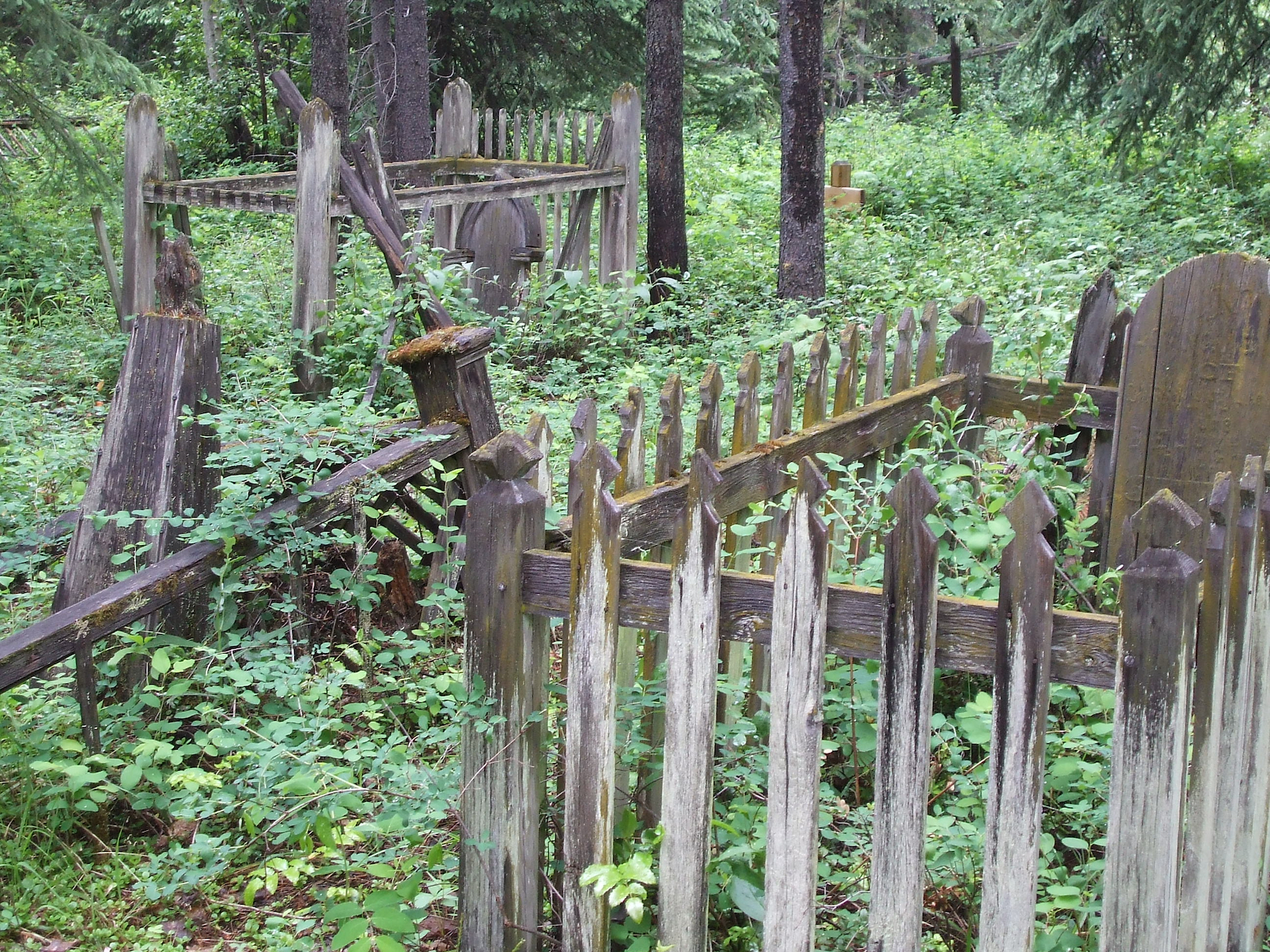
The overgrown cemetery at Donald has the same character of the ghost town it once served. Two of these victims, Evans and Green, were among the earliest internees at the little cemetery at the nearby divisional point of Donald, BC. Their graves are not marked today. Photo © TW Parkin.
From Timber to Stone
After another decade of such difficulty, the CPR moved to better solutions. Chief Engineer Paterson described the rationale for installing stone bridges and piers across the country:
We have adopted stone structures at a good many of our crossings, instead of iron, as we find that building these structures under a masonry specification they can be built as cheaply as iron, besides being much more substantial & while being as cheap, & in some cases cheaper, are much more economical, as they do not require painting, special floors or any repairs.
Cascade Creek numbers among several stone arches built in the Selkirks between 1898 and 1900. They include the Illecillewaet River (a 25-foot culvert), Mud Chute (a 40-ft arch) and Bryant Creek (a 50.5-ft arch).4 Such measurements are widths allowing stream passage below.
...much more economical, as they do not require painting, special floors or any repairs.
Drawing from a rare hand-written appropriation book now archived at the University of BC, this article covers a remarkable four-month effort that finally tamed treacherous Cascade crossing.5
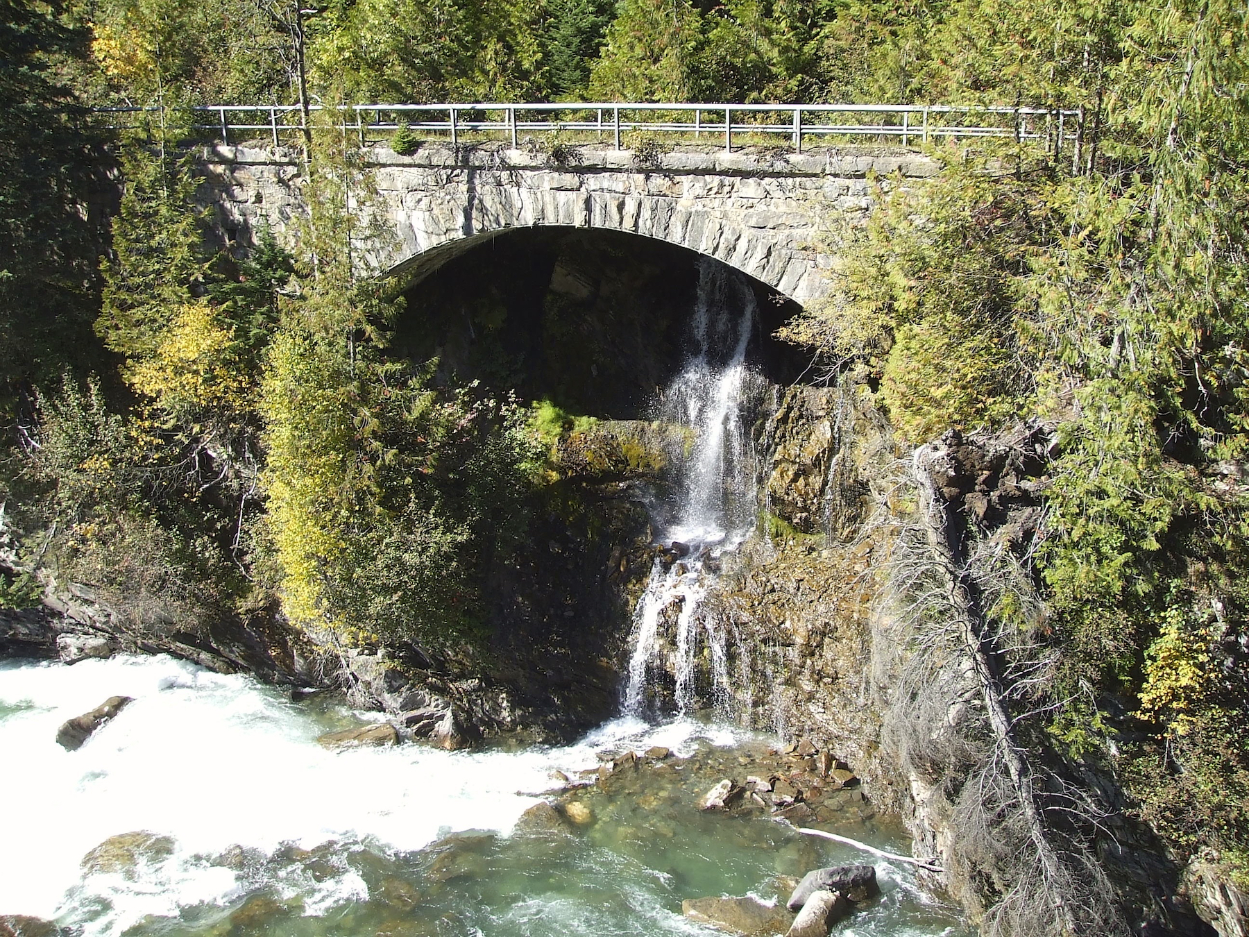
This granite arch over a steep unnamed creek was built about the same time as Cascade Creek. It replaced an 80 ft Howe truss. The arch spans 60 feet. The location is near Illecillewaet, at today’s CPKC Mile 99.5. It was abandoned in 1938 in favour of a 2.8-mile realignment on the other side of the Illecillewaet River. Photo © TW Parkin.
Reading the Construction Records
The notebook’s author is unknown, but as project manager, he was on site as of July 1898, recording “Anderson’s gang grading and laying spur”. It was situated just before no. 4 shed, where 2 or 3 cars could be set clear off the mainline on the narrow mountainside.6 This was likely where tent accommodation and a cook shack would have been erected as well. Anderson’s men unloaded cement as their second task. Building timbers were being brought in. Then, William Snider’s gang prepped for the stonemasons:
Page 209
Sniders Gang.
Grading Siding for Mason
Excavating for Piers
Enders Gang
Installation (Cptr).
Bains Gang.
Installation
Excavating foundations
Stone Cutting
Bridges D to K Wrights Gang
Excavating for 1 Bldg
Camps at Cascade
Chisholm’s Gang
Laying platform for Arch & making Templets
Altons Gang Loading Timber between Sicamous & Revstk
Carried Forward $1196.71
From the subsequent 1901 census of Canada, foreman William Snider can be identified as born in Nova Scotia in 1840, so he is 58. His German-born wife Margret lives separately in Revelstoke, and surprisingly, is 29 years his junior. They have children at home. Revelstoke was the new divisional point starting that year, because most CPR facilities and staff were being transferred from Donald as it was decommissioned.
The gang following Snider was led by foreman Enrico Ender of Lytton, BC. They were masons and likely began with the carpentry of the chords and braces depicted in the photo below. You may recall Ender being introduced in the pages of CP Tracks, in Part 3 of my article ‘Sleuthing on the Trail of Stone’ (Issue 16-2). Ender and company must have moved to other stonemasonry projects that year since they were a mobile gang. Chishom’s gang took their place and installed the board platform which topped the centering (formwork).
How the Arch Was Built
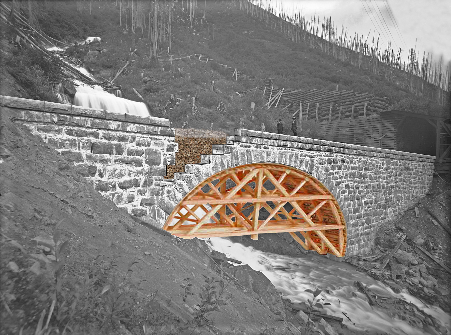
No known photograph exists of Cascade Creek under masonry construction, so this Photoshopped image by Maynard Atkinson illustrates the typical procedure of the time. Vaux family photo taken 3 August 1899. Credit: Whyte Museum of the Canadian Rockies, V653 / NG-551.
The wooden formwork, known as centering, was erected on solid foundations on either side of the creek and initially raised slightly above them using ‘knock-outs’ or wooden shims—temporary wedges or blocks. These supports allowed for precise positioning and easy removal once each parallel course of voussoir (ring) stones was secured by its keystone, making the arch self-supporting through friction and compression. At that point, the shims could be knocked out (not shown in this image), relieving the centering of any load and making it easy to dismantle at its bolted joints.
The structure comprised two exterior stone walls interlaced with the outer ring stones, leaving a void which would be filled with tightly packed rubble from a local source—mostly dry-laid, without mortar. In this image, one section of the wall has been graphically exposed to reveal this ‘packing.’ The rubble fill would then topped with ballast, which provided stability for the track embedded in it. As minor settlement occurred over time, additional ballast would be applied to maintain a level track bed.
The uppermost layer of coping stones was set to match the 2.1% gradient of the track and helped contain loose ballast. Over the years, continual ballast applications gradually rose to the level of the coping stones. On CPR masonry arches still in use, this ballast can now be found spilling over the edges.
Cascade Creek, a 60-foot arch built on solid rock foundations, cost $15,507.32 in 1898. To the right of the image (looking track east), Snowshed No. 3 stands as protection against avalanches, a necessary precaution in this mountainous terrain. Interestingly, the creek itself emerges from a subterranean cavern just a short elevation above the arch.
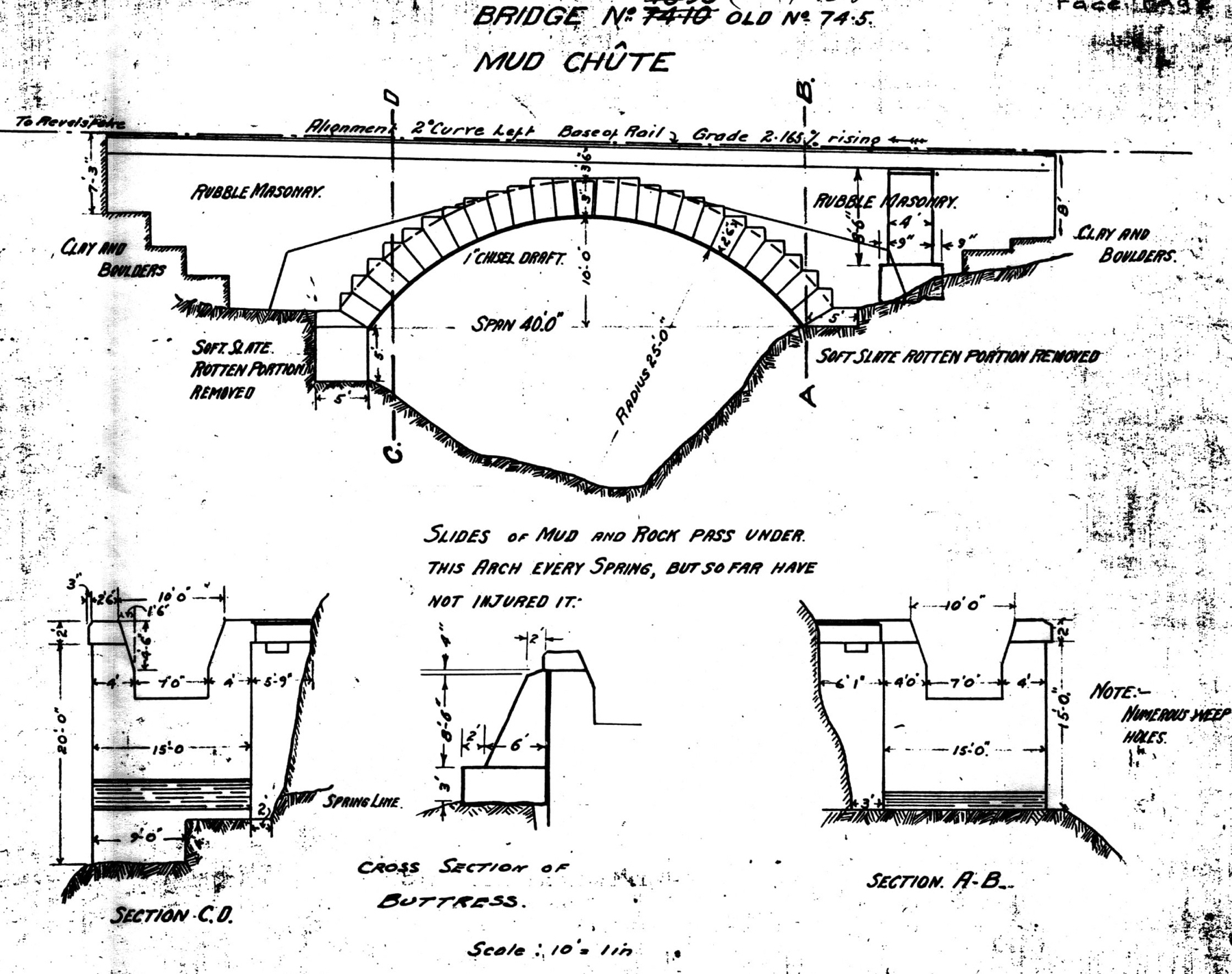
An as-built elevation drawing of a masonry arch over nearby Mud Chute is of the same style as Cascade Creek. It was built circa 1899 and drawn as shown here Dec 1932 and March 1957. CPHA Archive document.
From the remaining notes we can deduce a busy site with multiple foremen and their trades giving it their all in the short season of this high elevation (3,904 ft / 1,190 m). Daniel Alton was a CPR bridge foreman as early as 1895. Wright’s gang was possibly an extra gang, moving between Donald and Kamloops (D to K) as projects required.
One question the notebook doesn’t reveal is how trains kept moving during arch construction.
One question the notebook doesn’t reveal is how trains kept moving during arch construction. Several methods could have been used. For the purpose of my illustration, I’m assuming a shoo-fly was built immediately uphill from the bridge because the arch’s alignment is straight and tight into shed 3. Such a temporary bridge hugging the slope would have required slow orders and possibly removal of part of the shed to ‘soften’ the curve.
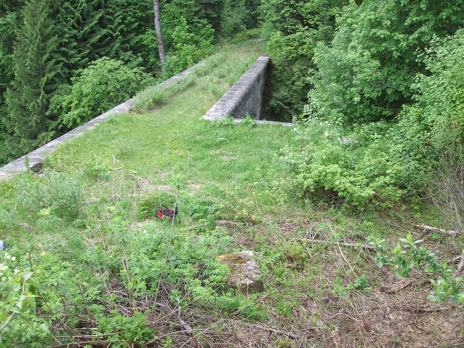
Showing the abutment in the right mid-ground. The open space in the foreground could have been enough to swing track to the right outside of snowshed no. 3 to pass over a shoo-fly alignment. A stone retaining wall is recorded as built at the time of the arch construction. Its value was $429.73. The upper length of the stone arch is 165 feet (50.3 m). Photo © TW Parkin.
The Men and Materials
At the bottom of the approbation book, on page 209, the author carried forward his expenses to date, but July wasn’t yet finished. Expenditures for the first month at the bottom of page 210 amounted to $2036.81. We now skip a few pages and find August underway with lots of visitors:
Page 212
Brought forward $4380.98 August Bridges D. to K.
J.H. Magee Gang New Bents & Stringers
Trainmen Shuswap & Selk.
ExpensesT Kilpatrick
P Moore
E Farr
LH. Buck
Thomas Kilpatrick was the bridge superintendent from Revelstoke, dropping in to be sure everything was matching the drawings he had approved. He was soon promoted to Divisional Super and was popular throughout the region. He later made himself into a foremost authority on snow fighting. His wife (they married 1903) was the matron of Revelstoke’s first hospital—they were a definitive “power couple” of their day.
Edward Farr was a masonry inspector who travelled over all of Pacific Region in his duties because he and his family were based in Vancouver. I’ve found him in records regarding the CPR’s major quarry in the Fraser Canyon. It’s mentioned below as “Camp 16”, later known as Hells Gate. I introduced that quarry in Part 2 of ‘Sleuthing on the Trail of Stone’ (CP Tracks Issue 15-4). Here is further proof of the distance that granite was distributed around the railway system.
The 1901 census shows Lionel Buck as an independent civil engineer from Revelstoke. Why he needed to be consulted with so many others available is an unanswered question. Same for Peter Moore, train dispatcher, also of Revelstoke. Could there have been delay issues which were best comprehended by a site meeting? At any rate, the project manager paid for everyone’s travel.
Page 212 [continued]
V 282 Aug. Mileage
V 285 “ Mileage
Bridge Dept Form 828
18336’ BM
51# Screw Bolts
420# Drift Bolts
200# Spikes
310# “
Casde Section Charges
Masy Inspr 8/31
Rock from Camp 16
5 Cars Cut Stone$25 $125 2 Cars Dimension Stone$12 $24 Wades Gang Labor Cutting Ring Stones
Selkirk Regular Labor a/c Side Track
Engineering Dept. P. Roll
Asst B.J&R Master P. Roll
Cement used 337 Sacks $2 $674 Explosives used $44.60 Rock from Rogers Pass 31 Cars $10 $310 Carried forward $6251.35
The reference above to “Cascade Section” refers to the CPR subdivision (not the structure under construction) which runs between North Bend and Vancouver, BC. It’s probably an internal journal voucher system by which other company departments charge back their expenses to another manager. Thus we see stone cut at Camp 16, plus its associated labour, become an entry at Cascade Creek camp.
The metamorphic rock of the Selkirk Range was not suitable for masonry construction.
As a retired stonemason, it’s interesting to see that entries distinguish between prepared stone and raw rock.
A quarry in nearby Rogers Pass produced 31 cars of material, but being cheap rubble rather than pre-shaped building granite, was used simply as fill. The metamorphic rock of the Selkirk Range was not suitable for masonry construction.
Below is the last page in the sequence of this project. It’s now November, and the first snow has undoubtedly fallen. Some of the masonry crew will probably return to Camp 16 to stockpile stone in preparation for 1899 projects. Others could have transferred to Rogers Pass crews to work as snow shovelers. They were much in demand.
Page 248 [October continued]
Cascade & Thompson Section Charges.
Masy Inspr 9/30
“ Expenses.
Wade Cuttg Copg Labor.
Copg from Camp 16 4 Cars $25 $200 Snider’s Gang Loading Rock
Bridges D to K Fraser Gang
Loading Timber
Removing Deck.
Davis Gang Building
Filling
Pointing
Cuttg Wood for Camp
Filling
Removal Plant
Engineering Dept P/Roll
Rock from Rogers Pass Quarry 5 Cars $10 $50 Personal expense P Moore
Frt on Crude asphalt Van to Rog Pass W/B 15626 Apl
Make credit Trainmen
Total to Nov 30th $15507.32
John J Fraser, bridge foreman, and his crew were from Revelstoke. Snowsheds and steamship docks were also their responsibility, so they may have been modifying the portals of sheds 3 or 4 to improve alignment for the new bridge. Fraser died in the infamous Rogers Pass avalanche of 4 March 1910 which killed 58 CPR workers. William Snider survived his career and may have considered himself a lucky veteran of the snow wars. He died in 1914 in Revelstoke at the age of 80.
The wording of these final entries of the project also indicate its conclusion. “Copg” stands for coping, the upper cap of a masonry structure which serves to drip water away from the stone surfaces below. Copes also serve to contain track ballast. William Snider is loading leftover stone for some future project in the continuing program of improvements. Only two pieces remain on the site today.
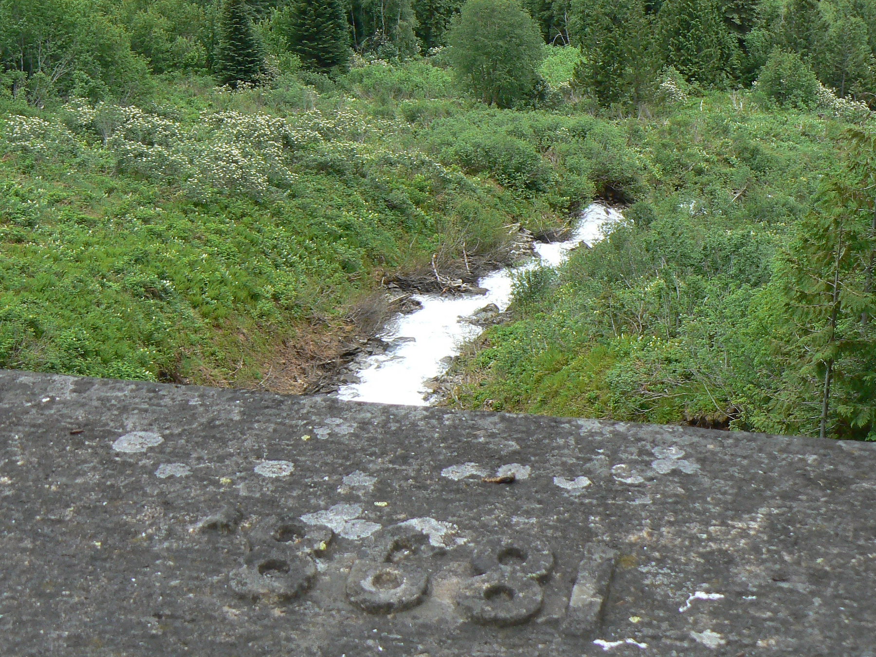
Viewing downstream from the centre of the arch. The year of installation carved by hand is much more laborious to do in relief than to mark it by engraving. This is the work of a proud craftsman. Avalanches still sweep the slope free of mature trees. Photo © TW Parkin.
Others are “loading timber”, “removing deck”, and filling holes or providing protective rip-rap with more rubble from “Rogers Pass Quarry”. Just what crude asphalt was needed for is beyond me—none is visible today!
...a reminder of an era when engineers met nature’s broadside blasts.
The expenditure of appropriations of other CPR projects can be read in this, and other, CPR account books preserved in the Chung Collection at UBC, Vancouver. This interpretation of the Cascade Creek arch shows how a simple survey of census returns, community directories, and newspaper records can be combined to present a new understanding of how and when historic projects were accomplished, especially by men largely uncredited during their careers.
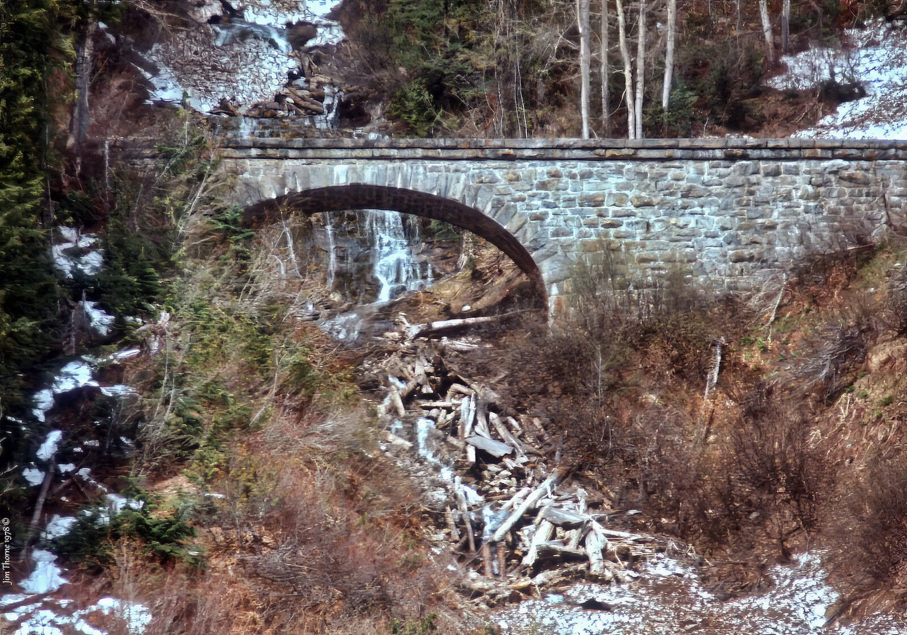
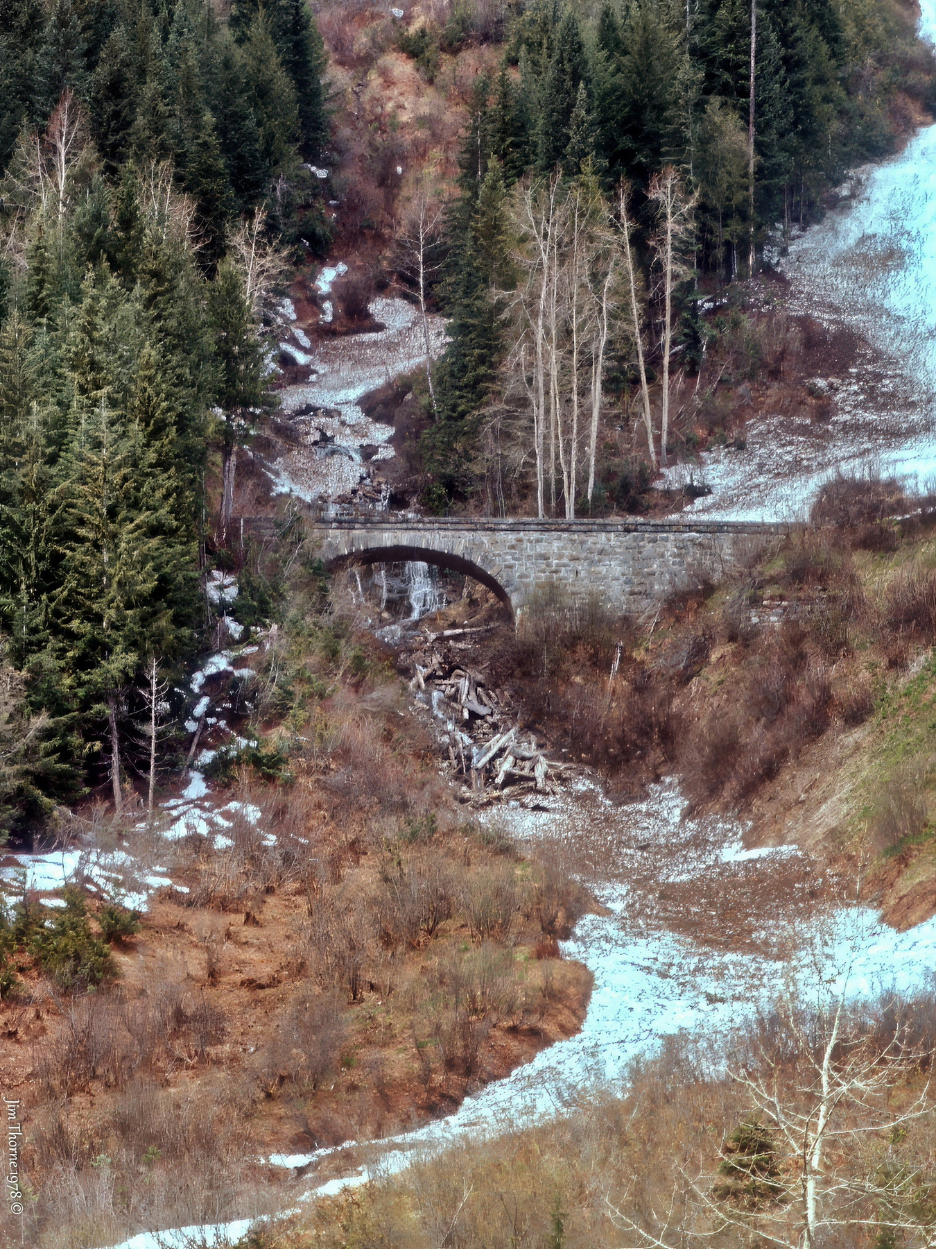
The completion of the stone arch at Cascade Creek marked a turning point in the CPR's ongoing struggle with the harsh environment of the Selkirk Mountains. For decades, it stood as a testament to the ingenuity and determination of railway builders who sought to tame the wild terrain of British Columbia.
Though bypassed by modern railway routes and gradually reclaimed by the forest, this historic structure continues to arch quietly across time—a reminder of an era when engineers met nature’s broadside blasts.
Endnotes
- Woods, John G, 2010. Snow War: An Illustrated history of Rogers Pass, Glacier National Park, BC. Parks Canada, 64 pages.
- Vaux, Jr, William S, 1900. “The Canadian Pacific Railway, from Laggan to Revelstoke, B.C,” Proceedings of the Engineers Club of Philadelphia. [Online]. Available: https://open.library.ubc.ca/collections/bcbooks/items/1.0348953. [Accessed: 06-Feb-2025]
- Chittenden, Newton H, 1885. Settlers, Miners and Tourists Guide from Ocean to Ocean by the C.P. R., the Great Trans-Continental Short Line through a Region of Unsurpassed Attractions for Settler, Miner and Tourist Ottawa, Canada, page 74. [Online].
- Burrows, Roger G, 1981. Railway Mileposts: BC Volume 1 - The CPR Mainline Route, Railway Milepost Books, page 43. Confirmed by Stapley, Leanne V, 2004. Mileboards Out of Revelstoke, Revelstoke Heritage Railway Society, 9 pages.
- Canadian Pacific Railway Company Limited. Pacific Division, “Account book of expenditures on appropriations,” 1898. [Online]. Available: https://open.library.ubc.ca/collections/chung/chungosgr/items/1.0355097. [Accessed: 06-Feb-2025]
- Plan of C.P.R. track, sheds, and buildings at Hermit, 1912. Revelstoke Museum & Archives. [Online]. Available: https://bcrdh.ca/islandora/object/revelstoke:26325. [Accessed: 06-Feb-2025]

Did You Enjoy This Article?
Sign Up for More!
“The Parkin Lot” is an email newsletter that I publish occasionally for like-minded readers, fellow photographers and writers, amateur historians, publishers, and railfans. If you enjoyed this article, you’ll enjoy The Parkin Lot.
I’d love to have you on board – click below to sign up!